Pumari Chhish (Pakistan) 2021
Our attempt on PCE
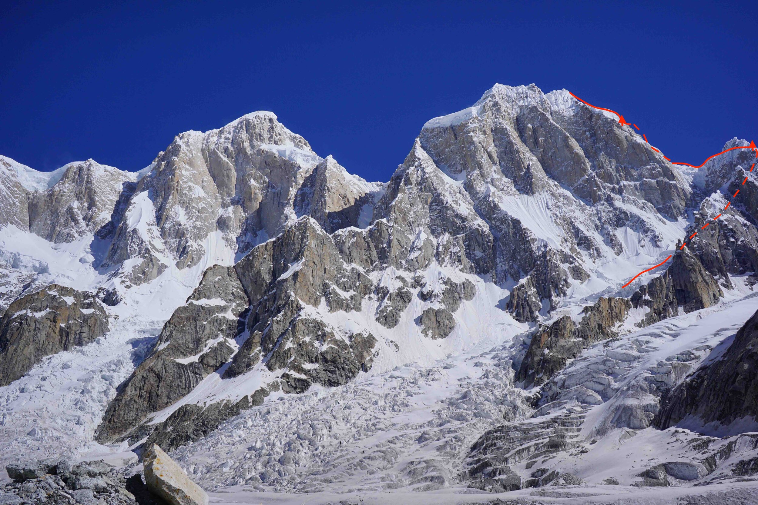
Summary: Attempt at south-east ridge of Pumari Chhish East (6850m) by Mathieu Maynadier and myself, July 2021. High point c. 6750 metres.
June 2021
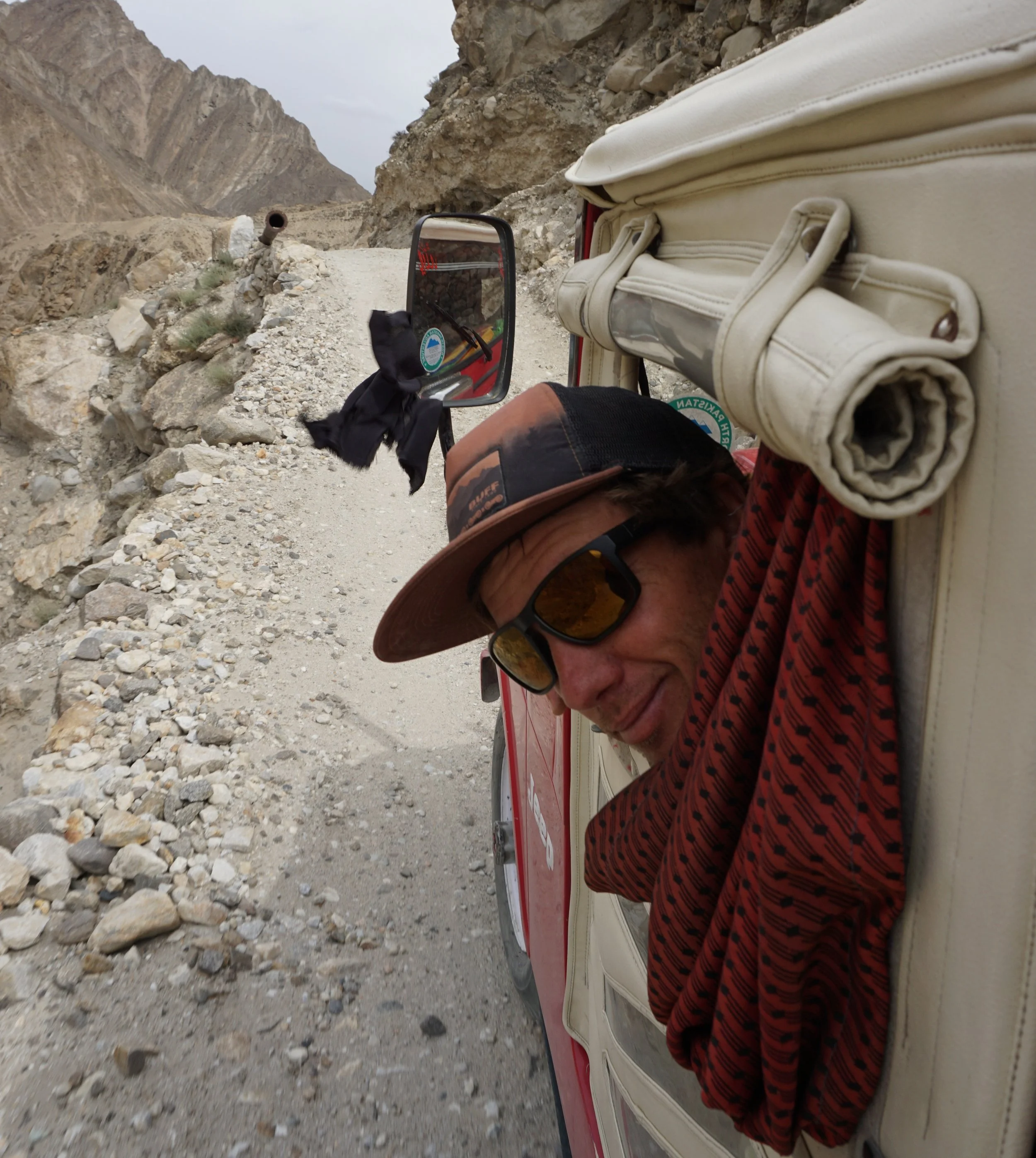
We blasted through Pakistan like a bullet from a gun, the beads which hung from the wing mirror flinging from side to side as the driver blasted the beat-up bus. The wheels hummed on a fresh tarmac road, painted signs announcing a ‘lasting friendship between China and Pakistan.’ We bellowed a plume of dust behind.
The country was evolving, hungrily clawing at development and prosperity. Even in the three years since my first trip here, the place had noticeably blossomed, foreign influences grown. The bus driver twirled and gestured his left hand as he happily chatted, his open palm or pointed fingers emphasising opinions. The hands of a Pakistani person can convey a hundred phrases and ideas.
The driver’s other hand directed the bus to overtake anything and everything. Elaborately-decorated trucks laden with sacks of rice and potatoes trundled along. Amongst them, tractors, wagons, motorbikes, cars, minibuses, animals - and animals in minibuses - all careered along like an artery in flood. It was a true Pakistani experience, a seemingly-organised chaotic computer game in real life. The tarmac quickly disappeared as we left Islamabad and aimed toward the enticing Karakoram mountains to the north.
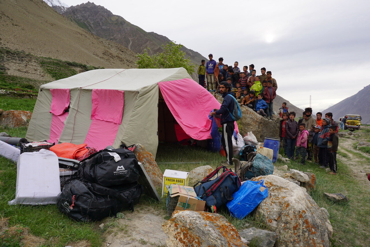
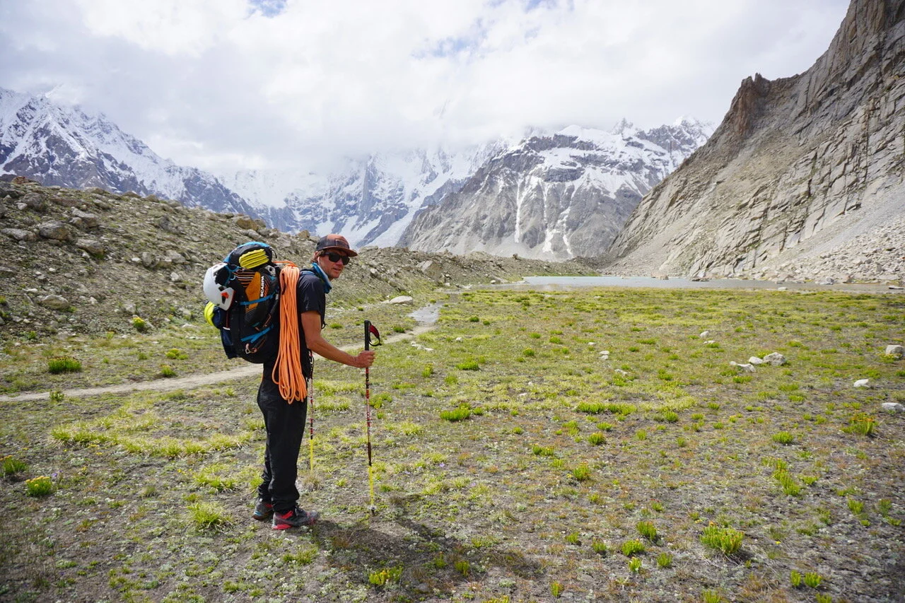
Mathieu Maynadier (Mémé) and I had four duffles each which slid around the back of the bus, crammed with the world’s best and lightest equipment… which made me wonder how we’d got so much weight! We had our sights on the Pumari Chhish massif (around 7000 metres) in the Hispar/Hunza region.


***
Base camp was a luxurious meadow above the Jutmaro glacier. It was the perfect altitude (4500 metres) with front-row seats of the front-row views of the south faces of Pumari Chhish Central (7492m) and East (6850m). For the past three days, we’d hired about 25 porters to carry our junk, food and equipment up the Hispar glacier. These tough, weathered men were incredibly sure-footed despite carrying 20 kilos. I got the impression we were walking through their front garden, such was their comfort in the mountains. The villagers were also hopelessly ruthless about money, not realising that every time they massively rip off an expedition, they ruin the likelihood of more climbers visiting the area for the next few years…
Meme and I started our acclimatisation by hiking to 5600 metres, but we quickly discovered the local weather was very different to our forecasts. The good or bad weather usually came in French, our forecaster announcing ‘tres beau temps’ when we had bad weather, and ‘gros orages, toujours mauvais’ when it seemed fair. Our meteorologist was having a hard job because the Pumari Chhish massif was in the lee of a bigger peak (Kungyang Chhish), which itself was one of the first big peaks to meet prevailing south-westerly weather. Pumari Chhish seemed to attract clouds and snow like a magnet, giving unstable and hard-to-predict weather. ‘Always in the clouds,’ seemed to become our motto. Looking down the valley, we’d see blue skies and wonder about our luck.
For the following weeks, we had sun, rain and snow every few hours. We finally accepted we’d have to skip the ‘ideal’ acclimatisation plan of sleeping at least one night 1000 metres below the summit of our main objective. I wondered if I was losing the plot when I went for a swim in the lake in heavy snow.
We continued to prepare for a route by stashing our gear below Pumari Chhish, and even found a way through the jumbled glacier to reach the base of the face. Previous teams had warned us of the glacier and it’s deteriorating state, but luckily we found a snow gully to sneak through.
Finally, on Thursday 8 July, the weather pattern shifted to the north and we expected four days of good conditions. It was a relief to see the mountains again after so many days of cloud and precipitation, and they ideally needed a few days to shape up. We reached the unfortunate conclusion that four days of good weather wasn’t enough for our main objectives, but we chose a consolation prize by attempting the south-east ridge of Pumari Chhish East.
The next day we reached our stashed gear beneath the mountain. On Saturday 10th we began climbing the south-east ridge of PCE. I’d read many reports of horrible, rotten, bottomless snow ridges in the Karakoram. Giant cornices and snow mushrooms give committing, engaging and run-out climbing. I’d even experienced this type of ‘fun’ on Latok 1.
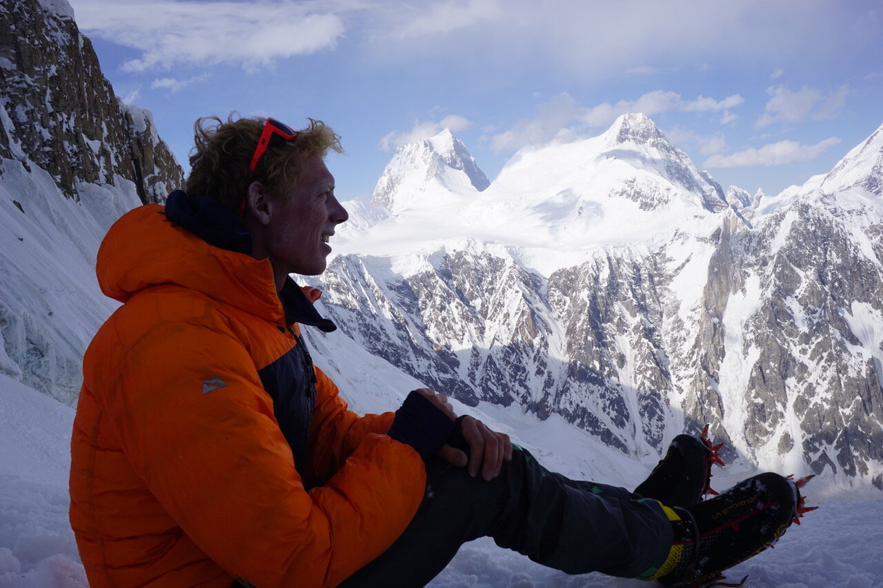
We spent the morning climbing up to the south-east ridge, then bivied. On the 11th we climbed along the ridge, which thankfully was mostly fine (we could dig deeply to find ice and create trenches through the snow). However, Meme led a particularly memorable section which involved down-climbing vertical snow-ice with little gear and down-mantling snow mushrooms, a 100 metre drop below our heels…


In the afternoon we walked up easy snow to about 6400 metres. I wasn’t psyched to be under so many seracs (there are about four big ones which we were directly beneath, and several more which looked menacing). I think it’s not a good idea to climb under seracs, nor to take extra risks on expeditions, and it would be a dumb way to get smoked. In fairness, there was no fresh debris - they didn’t look active. Meme was very motivated to continue. After much discussion, we decided to continue, and bivied (…logically, beneath a serac).
In the evening, we saw the weather pattern shift to the south again and it snowed lightly. On the 12th we rubbed our eyes awake at the usual 3 am. We poked our heads out of the tent to thick cloud and then heavy snow. ‘Hmm…!’ We started up anyway, sneaking through the seracs (which actually didn’t look too bad up close), then climbed moderate snow and ice to around 6750m in deteriorating weather. It was frustrating to be so close to the summit ridge but in worsening weather. This was supposed to be a clear day, so we were surprised at how wrong the forecast could be.


Heavy snow, spindrift, wind and thick cloud all gave for a very ‘Scottish’ experience. We could glimpse our approximate position, and knew that we were close to the summit ridge (although the actual top was further back/along the ridge). It felt like we pushed and pushed our luck and kept climbing higher in the worsening weather… but eventually we decided to bail. It was bittersweet to have climbed 99% of the mountain, but I felt happy with our effort and thought any other team in our position would’ve done the same.
That afternoon, we rapped back to our tent, which was half buried in snow. We then tip-toed down big snow slopes before rapping the logical descent line into the basin below PCE south face. We dragged ourselves to base camp that evening, arriving around midnight.
With more mixed weather forecast, the porters arrived at base camp on 18th July.
Meme and PCE
***
A few days later…
‘An aeroplane!’ I shouted to nobody.
My feet flip-flopped down the dusty trail. Sand and mud filled my trainers and caked my skin, the dry heat cracking my lips. A ‘hair dryer wind’ blew in my face, the endless walking and walking beginning to drag. Returning to civilisation after a month in base camp is a slow process which always takes longer than you’d like.
Looking up to the sky, enjoying a different view from the one of the past month, I saw the lone plane and it’s contrail cutting the bright blue. It was the first I’d seen in a month and I stopped walking, curiously amused at such a sight.
On trips where you’re relatively disconnected from the outside world, I enjoy the isolation and quiet which settles over you after arriving in base camp. The background hum of technology is replaced by a calm and focus for climbing. But the sight of the aeroplane was another hint at our imminent return to reality.
I stopped staring. My stomach rumbled, and as always, I wondered if this was… an unusual ‘movement’…? Have I got the sh…? - but then it settled again. I relaxed. Wiping a grubby finger in my eyes, sweat and dust and sand mixed around. Giving in to the inevitable fact that I had to keep walking, I leaned forward, momentum pushing my feet back into action.
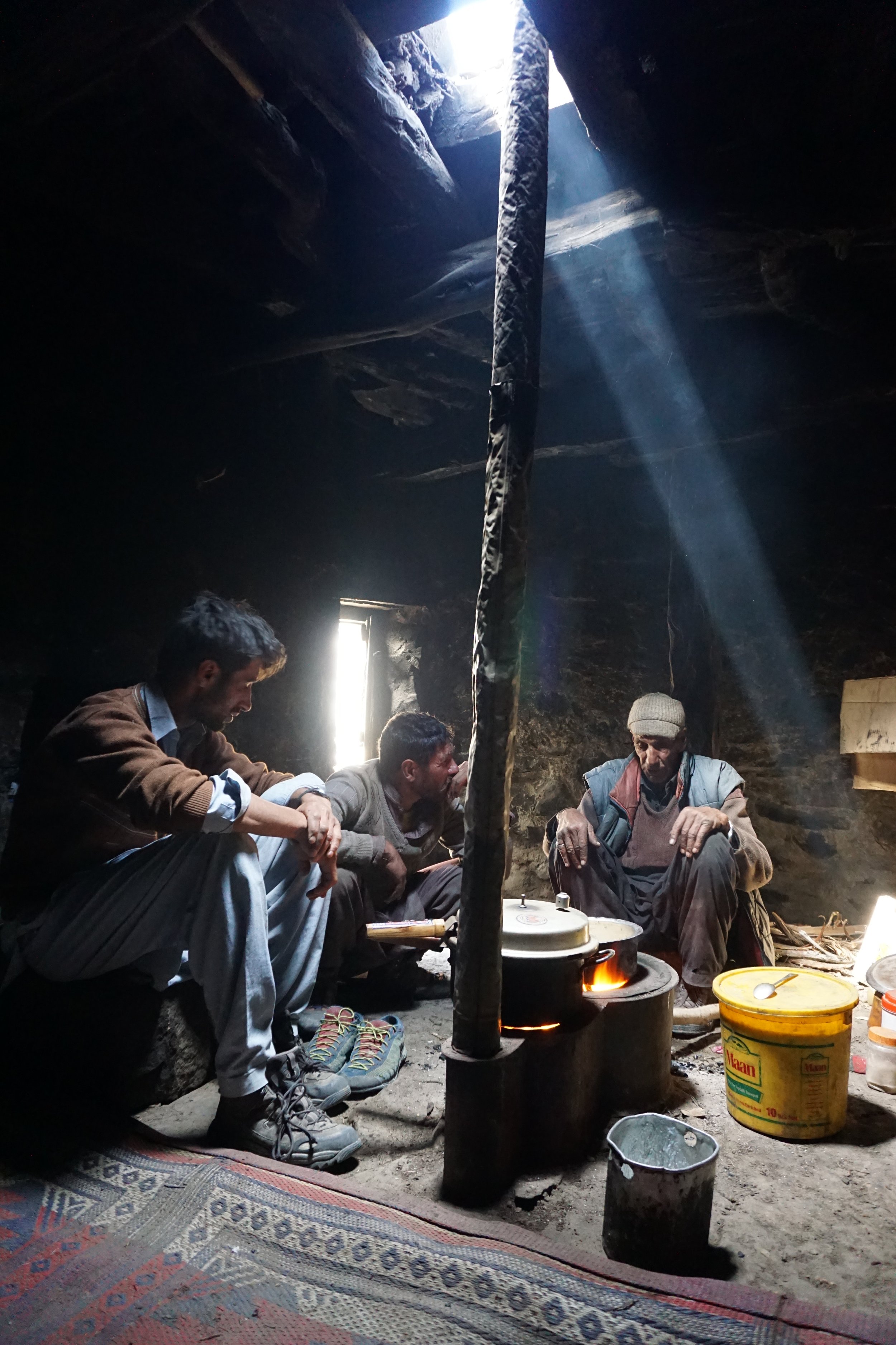
I followed enormous footprints in the dust, like tracking a gorilla wearing size 18 shoes. I knew whose feet had made these marks: one of the yak shepherds was travelling down from the mountains with us, returning to his village (Hispar) after tending the herd for the summer. A few hours earlier, we drank sweet chai in his smokey hut. Our trekking guide Mueez translated for us as ‘the grandpa’ shepherd spoke about his life: he was ‘about’ 80 years old, slept on a thin mat in the hut, and ate thick bread dipped in sour yak butter. He said life was very calm and simple in the mountains. ‘Everyone should be equal, regardless of race or religion,’ he said. I was shocked at his profound statement and agreed.
‘What about snow leopards?’ we asked curiously, since this remote and wild region might be a place to glimpse the elusive big cat.
‘Oh yes, we see them all the time,’ he replied nonchalantly. ‘In fact, a snow leopard took one of the herd last week…!’
I went back to my solitary trudging through the mountainous desert, thinking of hot showers and fresh fruit and rock climbing and a comfortable bed and seeing her smile and partying and vegetables and…
I drifted passed the occasional skeleton of a donkey or yak, half-uncovered in the dust like some emerging fossil offered up by the earth, the animal presumably dying of thirst or a snow leopard, and a reminder that I was still in Pakistan. But each step took me closer to home.
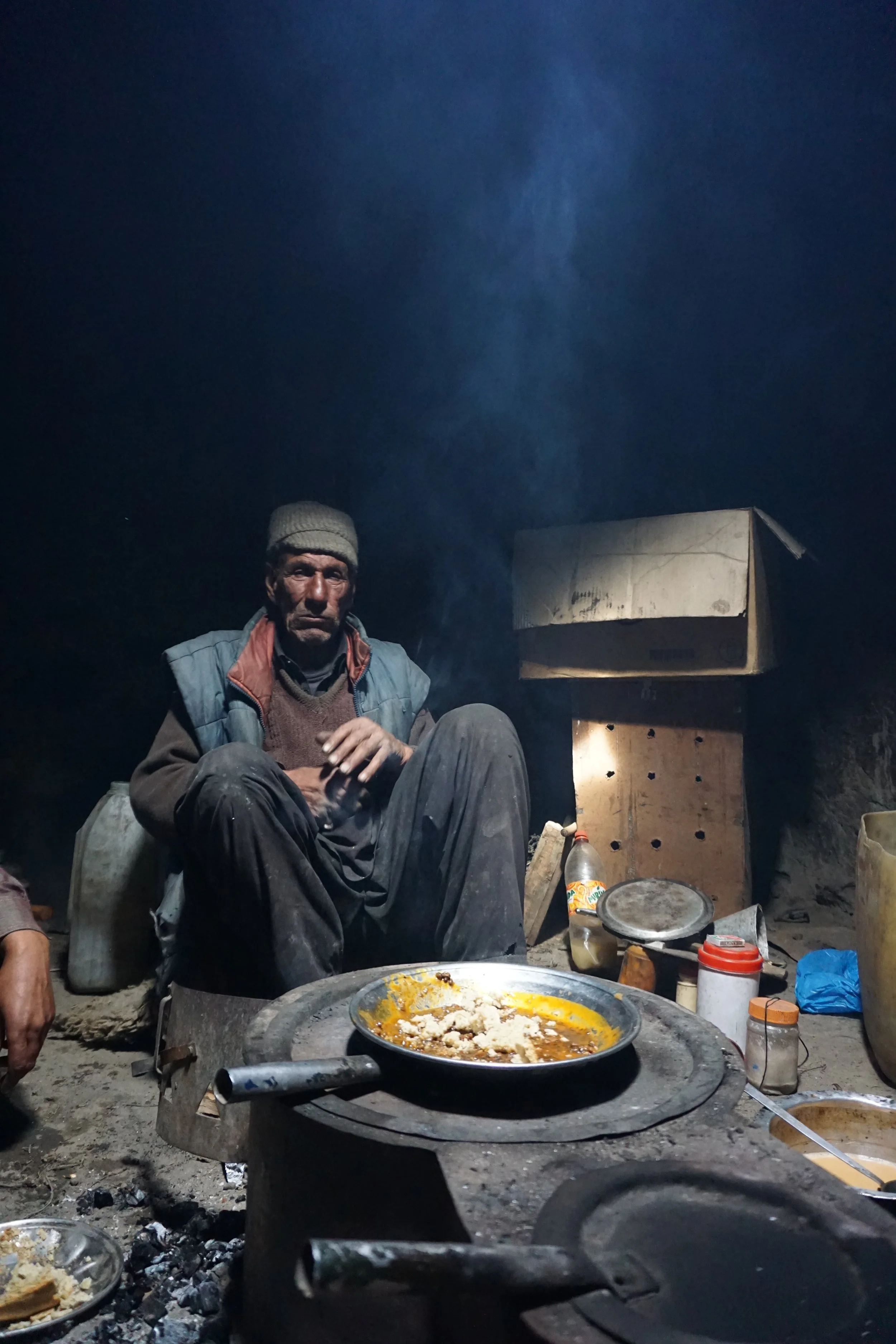
‘the grandpa’
‘the grandpa’
Summary:
Attempt at south-east ridge of Pumari Chhish East (6850m) by Mathieu Maynadier (France) and myself in July 2021. High point around 6750 metres.
Thanks to Rob Smith and Yan for the weather forecasts, to Mueez (guide) and Shoukla (cook), to Ishaq, and North Pakistan Adventure.